Overview
The Mountaya Insight Editor is a powerful open source application designed for geospatial analysis for large-scale data sets. It empowers anyone to design sophisticated maps, either for private analysis or for sharing within the Mountaya platform as part of our Mountaya Insight Series (coming soon). The Insight Editor is available to anyone at https://editor.mountaya.com.
The code is open source under the MIT license and available on GitHub: @mountayaapp/insight-editor.
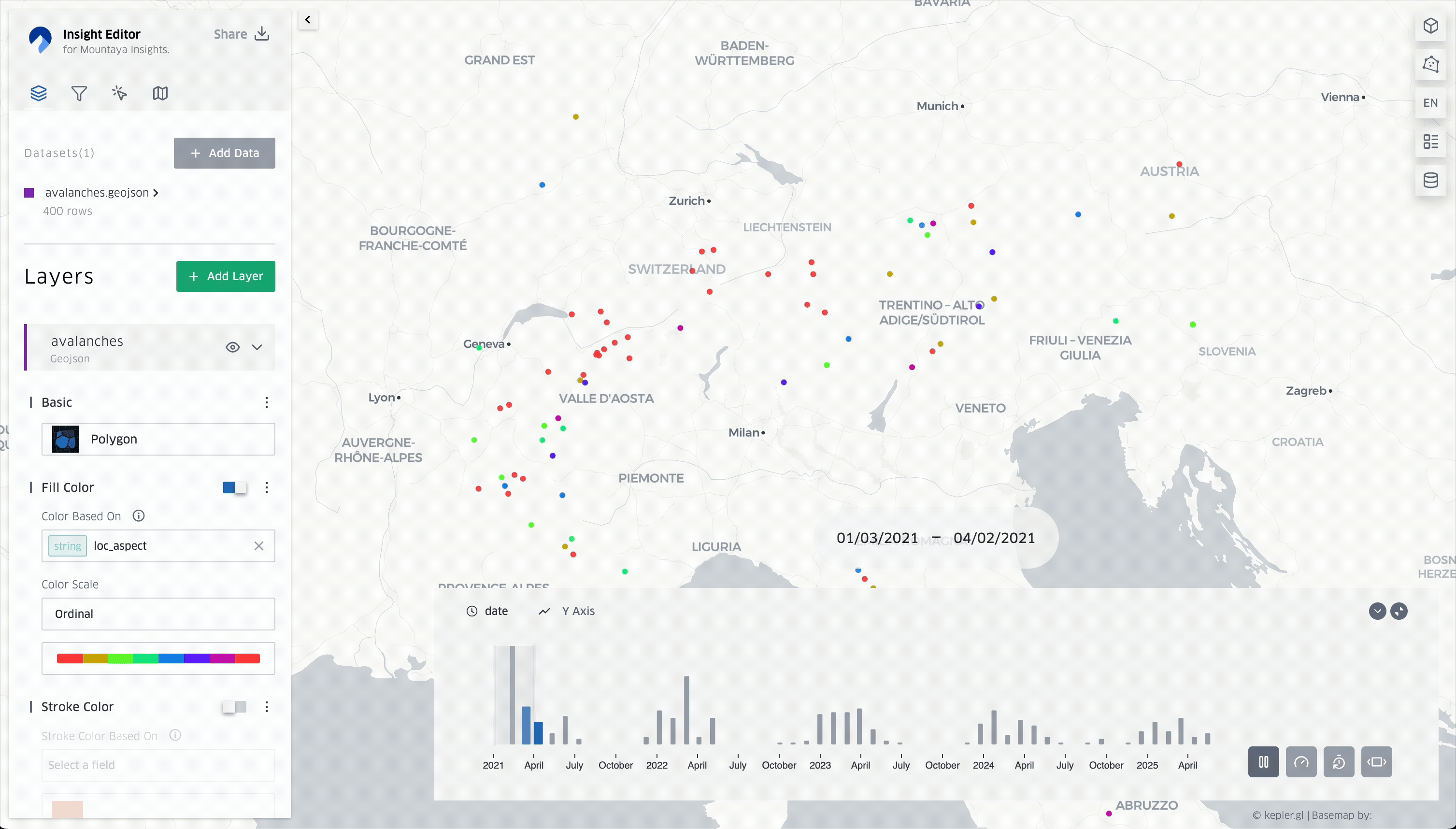
The recording below shows a timeline of avalanches from 2021 to present day. The color of each point is displayed based on the avalanche's aspect (e.g., north, northeast, etc.), while the Y-axis of the timeline represents the number of fatalities.
Beyond this editor, Mountaya offers professional services to our partners to transform their geospatial challenges into clear, actionable insights. We provide comprehensive, end-to-end solutions, including:
- Tailored map design: Data visualizations with the Mountaya Insight Editor, designed to highlight your unique data and objectives with clarity and impact.
- Custom ETL/ELT data pipelines: High-performance, tailored data pipelines that effortlessly integrate, transform, and process your geospatial data.
- Powerful Tile APIs: Scalable Tile APIs designed to perfectly align with your mapping and analytical needs.
The result of these personalized solutions, known as a Mountaya Insight, is the map exported by the Insight Editor. This workflow ensures a powerful, seamless, and unified experience across all Mountaya Insights, helping you to visualize and understand your most complex geospatial challenges with unparalleled clarity. You maintain full control over your Mountaya Insights, choosing whether they remain exclusively private to your organization or are shared with the wider Mountaya community as part of our Mountaya Insight Series.
Ready to get started with Mountaya Insight Editor and Insight Series? Complete our access request form and we'll get back you.